
For the latest information and updates on the Nelson Tenths, please visit www.tehereanuku.nz, a comprehensive website dedicated to Te Here-ā-Nuku | Making the Tenths Whole and our commitment to hold the Crown to account around the Nelson Tenths agreement.
Nelson Tenths & The Settlement of Nelson
Wakatū owners are descendants of the chiefs and families of these hapū that belong to four tribes, Ngāti Koata, Ngāti Rārua, Ngāti Tama and Te Ātiawa. Our ancestors travelled from Kāwhia and North Taranaki to conquer the region (Te Tau Ihu) between 1828 and 1834.
They settled and held authority (manawhenua) over the Nelson, Motueka and Golden Bay lands at the time of European settlement in 1841. Our families were based in the following regions:
Ngāti Koata – Rangitoto (D'Urville Island), Croisilles and Nelson
Ngāti Tama – Wakapuaka, Golden Bay and Nelson
Ngāti Rārua – Motueka, Golden Bay and Nelson
Te Ātiawa – Motueka, Golden Bay and Nelson.
Our ancestors had large gardens and cultivations from which they supplied goods to the whaling industry in Marlborough, which was at its peak in the 1830s. Later they became the main providers of food to Nelson settlers.
The New Zealand Company
In London during the early 1840s, the New Zealand Company (NZC) planned for the settlement of a town called Nelson. NZC intended to purchase some 200,000 acres of land from Māori, which it would divide into one thousand lots and sell to intending settlers. Due to its superior harbour, the site which Nelson City now occupies was chosen. However, the cultivatable land surrounding the harbour amounted to only 60,000 acres, less than a third required for the NZC’s plans. Nevertheless, NZC continued with the settlement and secured an undefined area of land from our ancestors. This included Nelson, Waimeha, Motueka, Riwaka and Wakapuaka.
Motueka lands and Tasman Bay
The NZC agreement between our ancestors and the NZC included conditions that one-tenth of land purchased for European settlement in the Nelson, Motueka and Golden Bay regions would be set aside exclusively for the benefit of Māori owners. We would also retain our traditional occupation lands, urupā (burial lands) and waahi tapu (sites of cultural significance) separate to the Nelson settlement.
Tenths Reserve Estate
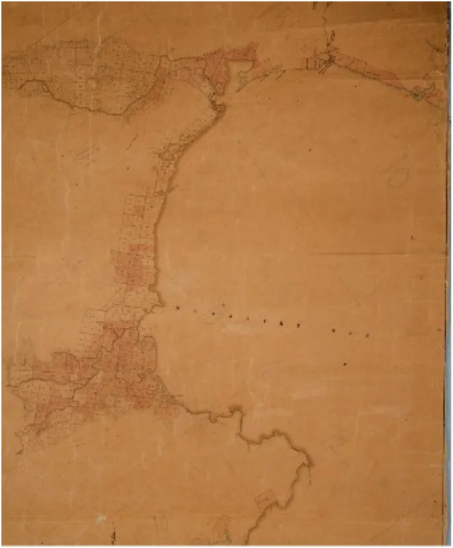
New Zealand Company Massacre Bay Map
Whenua Ngahuru
A key component of the NZC colonisation scheme was the agreement to reserve one-tenth of all land purchased for the on-going and future prosperity of its Māori vendors, our ancestors.
The Tenths Reserves were vital to the success of the New Zealand Company's scheme, and was the main reason Māori in Nelson and Wellington agreed to the settlement of their land. The Tenths were the “consideration” or payment for the land that the New Zealand Company was sold for settlement purposes. Māori anticipated that European settlement would bring many advantages.
The NZC also undertook to protect and reserve all Māori occupation lands, urupā (burial lands) and wāhi tapu (sites of cultural significance) from European settlement.
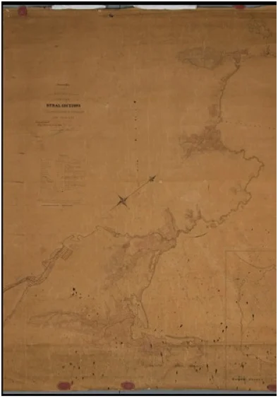
New Zealand Company Rural Sections Map
The full one-tenth of land was never reserved in Nelson as agreed. Nor were Māori occupation lands, urupā and waahi tapu sites protected. Although some land was selected as ‘Tenths’ in Nelson and Motueka, this fell well short of the agreed area. Furthermore, occupation lands in Motueka were included in the Tenths, when they should have been excluded from the New Zealand Company’s scheme. When those occupation lands in Motueka were finally excluded, the Tenths estate was not compensated for the loss to the Tenths estate.
The Rural Tenths were never allocated, despite being identified by the Crown, leaving the Tenths Reserves estate short by 10,000 acres. Despite a large Māori population at Motueka and a number of important pā in the surrounding area, no Māori habitations, cultivations or urupā were exempted from the surveys for Occupation Reserves, urupā and waahi tapu.
Eventually 1,700 acres of Tenths Reserves at Motueka and Mārahau were re-designated as Occupation Reserves to provide habitations and cultivations for resident Māori, causing further loss for the Tenths Estate.
Given then taken away
Forty-seven acres were taken for the remodelling of Nelson town in 1847, 429 acres were taken in 1853 for an Anglican school at Motueka, 85 acres were lost to public works, streets and roads, and 1,145 acres were sold by the Māori Trustee when a 1967 Act allowed lessees to freehold land. This left fewer than 2,000 acres of the 15,100 acres of Tenths Reserves agreed to by the New Zealand Company in our ownership.
New Zealand governments in the 1880s and 1890s enacted legislation allowing lessees rights of perpetual renewal and 21-year rent reviews. This further alienated our land from the owners and severely restricted the income it produced.
Until 1897 Government-appointed administrators used income from the Tenths in whatever manner they believed to “benefit” the owners. There was no consultation with the Māori owners.
From the 1890s until 1956 a partial distribution of income from the Tenths was made to those Māori individuals and families who were identified as the owners of the Nelson Settlement district. The Native Land Court identified those owners in its judgment of 1895, which recorded the names of all of those rangatira (chiefs) and their families who lived in the Nelson Settlement district in the 1840s, who had the authority to agree to the New Zealand Company proposal to settle the area.
Return to Māori control
After many years of protest and debate lead by the Māori owners, legislation was exacted enabling Māori incorporation’s or trusts to be formed to administer their own reserves. Wakatū was established by order in Council in 1977 by the descendants of the original owners of the Tenths Reserves. At that time, the Crown handed back control of approximately 1,393.72 hectares of land. This was the remnants of the Tenths Reserves and occupation sites. But, generations of oppressive legislation meant the return on assets was minimal.
Growing our assets
Wakatū was determined to bring about change. Together with other organisations and individuals, Wakatū lobbied against the unfair lease regime. New legislation enacted in 1998 allowed Māori to finally set market rents for our own land.
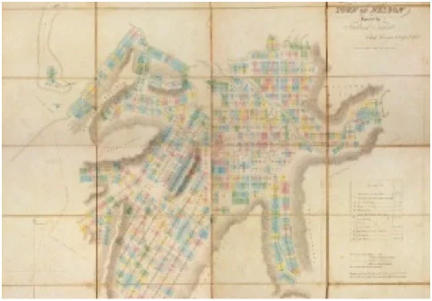
1842 New Zealand Company map
Since 1977 Wakatū has grown its estate from $11 million to a current value of over $350 million. Wakatū has worked hard to develop dynamic Māori businesses, with over 400 staff and approximately 4,000 owners.
“It is difficult for me to explain my own emotions and those of our people who were present when the Māori Trustee handed me the deeds and titles of our lands. After years of frustration we have moved closer towards achieving that which we all want – the complete control of our lands.” Wakatū Incorporation’s first chairman, Kahu Kōtua, opening the 1978 annual report.
